 | Ethical aspects of GIS |
|
|
|
|
|
|
|
|
|
|
|
|
|
|
|
|
|
|
|
|
|
|
|
|
|
|
|
|
|
|
|
|
|
|
Onsrud, H.J., Identifying Unethical Conduct in the Use of GIS, Cartography and Geographic
Information Systems, 1995, 22(1), 90-97
Identifying Unethical Conduct in the Use of GIS
Harlan J. Onsrud
National Center for Geographic Information Analysis (NCGIA)
University of Maine
Orono, Maine 04469
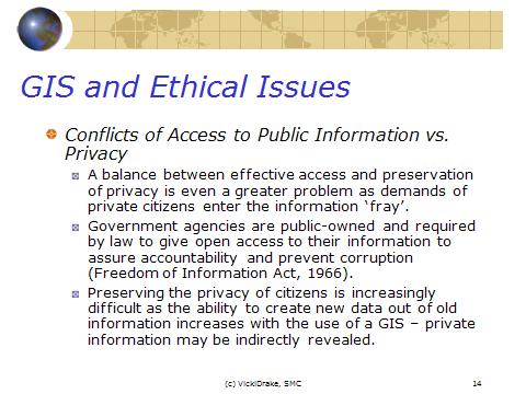
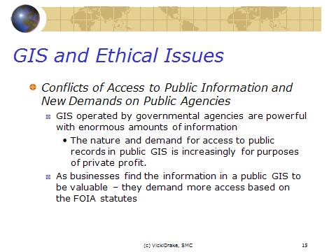
The GIS community often uses background, income and other private information that can involve an questionable and unethical conduct in the use of Cartography and Geographic Information Systems.
Harlan J. Onsrud, the author of the article Identifying Unethical Conduct in the Use of GIS, 1995, keeps attention on ethical aspects of GIS. In his opinion GIS users have to think about the power of geographic information system technologies and GIS technology should be used only for "good purposes", and distanced from either illegal or unethical goals.
The author argues that ethical aspect have to be a number one when we use information and database. We should remember there are only minimum standards of behavior established by law. The more sophisticated unethical cases are ignored by legislation because it can be very difficult or highly impractical as illegal. However, we should recognize unethical case. The rule is very easy: our ethical conduct is the behavior desired by society, but it is not easy to realize this rule practically.
There are many ways to work when can be unethical cases and one of that is THE PROFESSIONAL CODES OF CONDUCT for GIS members even the GIS community is new enough. Codes of conduct already have been developed for many closely related groups and prepared by the Association of Computing Machinery (ACM), the Data Processing Management Association (DPMA), the Institute for Certification of Computer Professionals (ICCP), and those organizations that regularly sponsor conferences on GIS issues. The more generalized tenets and moral responsibility contained in the Mount Carmel Declaration.
Usually codes of conduct prepared by professionals as a frame of member behavior in the concrete organization are only intended as goals to aspire to, but statutes of the organization carry the force of law and codes of conduct can be adopted by state licensing boards, but the problem is that intentionally the conduct is described here in such general terms that it is impossible to enforce in practice. In the other hand, even the codes of conduct contents only formal sanctions for members who blatantly step over the bounds of ethical conduct, the organization can get ōbad reputationö and lose its respect. The authorÆs conclusion is: professional society codes of ethical conduct is important and ōshould be prepared by gauging opinions of both the discipline and at least that sector of the public likely to be dealing with the products and services provided by the discipline.ö
Understanding that the code of ethical conduct for GIS involved professionals is very important, Harlan J. Onsrud does not to have only paper exercises. Developing ethical guidelines for the GIS community is very problematic due to the amorphous nature and newness of the community. Development should be cautious. One way to solve this problem involves updating the ACM''s Code of Ethics and Professional Conduct. Another way is in summarizing the GIS practice. The author recommends the following three steps:
1. Describe conduct situations currently occurring or likely to occur in GIS practice that may give rise to ethical decision-making.
2. Obtain opinions from members of the discipline on the appropriateness of the conduct described.
3. Obtain opinions from members of the public on the appropriateness of the conduct described.
The author remarks that it is the actual question within the GIS community. For instant, any principles can be derived and tested through the focus group process. One positive example of scenario modeling is in Ethical Conflicts in Information and Computer Science, Technology, and Business. The resulting questionnaire has been tested with focus groups of discipline experts and with focus groups of members of the public who might be involved in consuming GIS products or services. The questionnaire is merely illustrative at this point and numerous other hypothetical scenarios should be added prior to its actual use with focus groups.
In appendix part of the article, the author gives colorful examples of the questionnaire to illustrate the types of ethical conflict scenarios that might be solved with focus groups and same scenarios to cover such problems as providing insufficient data quality in the GIS database for unforeseen uses and therefore causing unreliable decision making, causing unintentional harm to others such as degradation in the quality of life or safety of others through the use of GIS, selling the same GIS product to a second client without acknowledgment, protecting "sweat of the brow" when a GIS database is not protected by copyright, allowing deception in the use of GIS for analysis where the means are suspect but a socially desirable result occurs, and causing intentional harm to others through the use of GIS.
Discussing philosophical perspectives of codes, the author agrees with this perspective to create a code through observation and analysis of current practice contexts and moral conditions: code and practice should be evaluated and honed by continuously reassessing with theory. He thinks that the first step is the definition of the word ōethicsö. So, philosophers have defined ethics as "the science of conduct." Ethics may be construed as a science in the sense that its study involves rational
inquiry and the overall goal is attainment of truth. Ethics also focuses on the study of conduct as
opposed to behavior. Behavior refers to activities in which people engage whereas conduct is a
subset of behavior "... in which persons make voluntary choices between alternative courses of
action... Theories generally fall within three classes: utilitarian theories, goodness of motive theories, and morally appropriate theories. All previews definitions not define clearly the problem GIS and ETHICS. But the theories of ethical study have many areas of agreement and have value in assessing
behavior in the GIS community. Such concepts as autonomy of the person, beneficence and
nonmaleficence, rights of individuals, and some aspects of paternalism appear to have relevance
across many of the theories of the ethicists. That once we know more about the current moral condition of GIS use, any derived code of conduct should be critiqued from a range of theoretical ethical perspectives and rules derived from experience obtain their final theoretical form.
The author remarks that social critiques of GIS are mostly moralists then ethicists (usage of GIS in war or "lie with maps" for example). They ignore the more democratic and humanistic form of geographical knowledge thru GIS, increasing access to marketplace goods and services, for protecting the environment and etc. ōMany of the moral causes, of course, may conflict with each other. The ethicist questions the underlying principles and theories upon which the moralist stands. Such questions may dampen furtherance of a moral cause but they also help us evaluate which moral causes have merit and may be worthy of our supportö, underlines Harlan J. Onsrud.
The philosophical aspect is very important for GIS professionals. ōIn developing rules of conduct for the GIS community, one problem in beginning with ethical theory and then moving to a GIS practice context is that of the disparity among the theories and derived principles of the respected ethicistsö, concludes the author.
There is another aspect of GIS practice and its estimation in ethical light. The significant number of GIS developers and practitioners has preconceived ethical notions of conduct that the rest of the
professional community and the general public. At present, we do not know the opinions of these people, but thru of opinion gathering and analyses process, we could be evidence and correct this fact. If it is known that a proposed action may be considered unethical or marginally ethical by a significant number of people, this allows the GIS practitioner to better weigh the potential drawbacks of the action against the potential benefits. Knowledge of various reasons and opinions can be very helpful in the action that can be taken.
The article is about how to practically avoid unethical and questionable conduct that is currently occurring in the development and use of GIS. This work is supported by the National Center for Geographic Information and Analysis (NCGIA).
H.J. Onsrud, ōLiability in the Use of GIS and Geographical atasetsö in: P. Longley, M. Goodchild, D. Maguire, and D. Rhind (eds.), Geographical Information Systems: Vol.2 Management Issues and Applications, John Wiley and Sons, Inc., 1999, pp. 643-652.
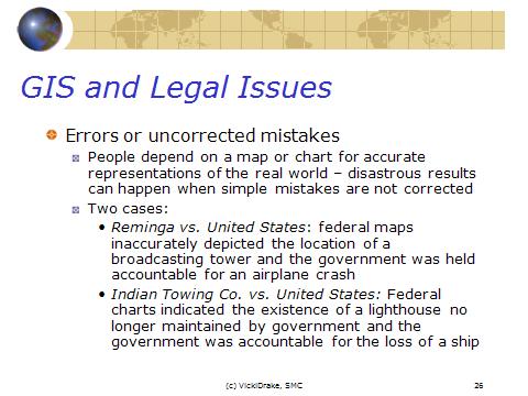
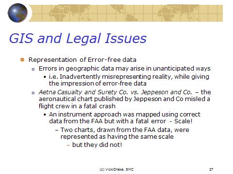
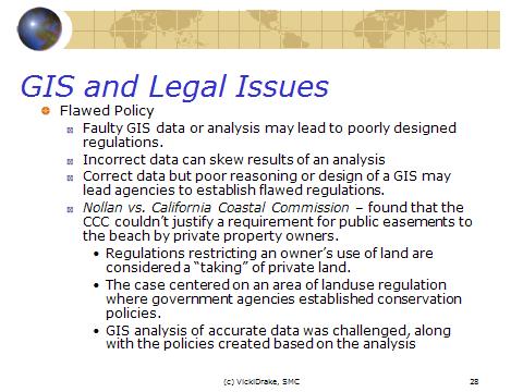
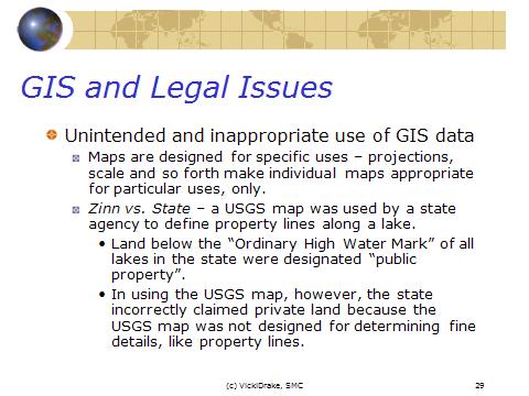
Liability is a subject of great interest in the GIS community because using of GIS data and software inevitably results in some action or decision and errors have resulted in inappropriate actions or decisions. There are several cases for that liability.
First, legal liability for damages is a harm-based concept. For instance, those
who have been specifically hired to provide data for a database or those who are offering data for
sale to others are responsible for some level of competence in the performance of the service or
for some level of fitness in the product offered. In commercial settings, liability exposure often may be reduced through appropriate communications, contracts, and business practices.
However, the law does not require perfection. It is also inevitable that errors and blunders will be contained in any practical database. Thus, the law holds that those in the information chain should be liable only for those damages they had a duty to prevent. Legislation may impose additional or
alternative liability burdens. Legislation affecting liability for spatial datasets and software
typically might be found in statutes addressing such issues as intellectual property rights, privacy
rights, anti-trust issues, and access rights.
Second, liability in GIS is further confused by current and potential applications of geographic information technologies. Each application requires integration of information specific to the application and often will involve different attributes, analytical methods, spatial features, and accuracy requirements. The specific software and end users will also vary depending on the application and the complexity of the legal questions of liability combined with the diversity of problems to which geographic information technologies are being applied has tended to create diffuse, changing, and undefined liability concerns.
Third, there is a question of licensing arrangement for GIS software, datasets, products, and services. Whether GIS products or services are custom-developed or software and datasets
are sold prepackaged for the general consumer market, the relationships between the producer
and purchaser or user will probably be affected foremost by contract law principles with warranty. In addition to warranty claims, the disappointed party may attempt to pursue a parallel tort claim, such as negligence, in order to expand the types and extent of damages that might be covered or to raise a broader range of duties on the part of the technology product producer. Also, statutes of limitations may vary.
Tort theories come to the forefront when the goal of the law is to prevent harms to the public
generally. In some instances, antitrust may be relevant. Infringement of rights to intellectual
property, personal privacy, and access to government information may also give rise to
responsibility for damages. Specific laws in regard to liability are dependent upon the specific laws of individual nations. Many of these fundamental principles are illustrated in the Restatement of Law documents and the Uniform Commercial Code.
This article contents several scenarios as an example for each case in a GIS context: an illustration of contract liability concepts; warranties; good, and its transfer rightful; tort liability concepts.
A tort is a private or civil wrong or injury to a person or property, which does not arise as the result of a breach of contract. There are no fixed and rigid classifications for torts. Two major policies supported by tort law are punishing wrongdoers for their conduct and compensating injured parties. If both policies can be supported by transferring money from the wrongdoer to pay for the damages of the party harmed, the rationale is strong for granting tort relief. Although there are no rigid classifications for judge-made tort law, there are some traditionally recognized or classic tort situations: harms, negligence, and strict liability. The primarily judge-made law of torts has been summarized in the U.S. in Restatement of the Law (Second) Torts. In most instances, a GIS product or service provider can do economic damages. Another possibility for maintaining a parallel negligence action would be through a claim of "professional malpractice." Malpractice occurs when an individual does not perform to the expected standards of one''s profession.
The article includes some cases of liability in neglect and fraudulent misrepresentation cases and false information for the guidance, fraud in the inducement, strict product (defective products) and etc.
Some time liability can be discussed. For example, a thirty year old driver bought the CD at a local discount store and has been using it for several months to aid him in routing himself through the city to deliver flowers in his part-time job with a small florist. After typing in the addresses of his deliveries for the day, the system calculates a route. Half way through his deliveries the system gives him oral instructions to turn right at the next street. He turns right and drives down a major one-way street in the wrong direction. This results in a head-on collision with another vehicle and he receives major physical injuries. Upon investigation, it is determined that no data was entered into the system wrongly nor was there a malfunction in the software. Rather, it is determined that the street recently was changed from a two-way street to a one-way street by the city.
This is the authorÆs opinion for this case. There is no manufacturing defect in the provided vehicle routing software nor in the separately purchased dataset. However, the injured party may argue that the system was defectively designed and poses too great a threat to physical injury from a safety hazard perspective as designed and implemented. Any reasonable system designer should have known that the directions of streets, lo
