 | California Geology |
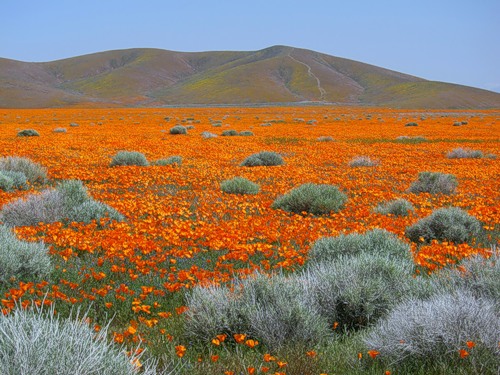
Весной на короткое время Антилоповая долина, расположенная в пустыне Мохави, покрывается коврами маков, а ветер, завывая, гоняет волны по бескрайнему морю огня, разнося кругом дурманящий аромат разогретых на солнце цветов... |
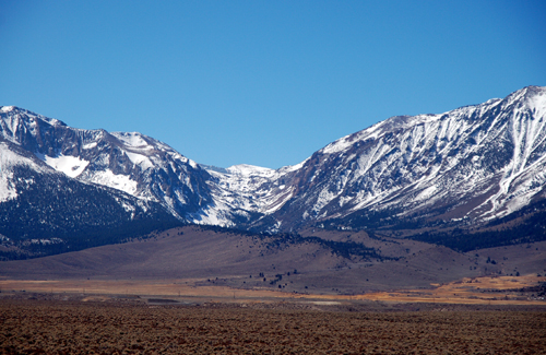
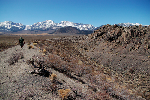
the Owens Valley and the Sierra Nevada,to Mono Lake, to the Carrizo Plain National Monument, to the Mojave Desert National Preserve, |
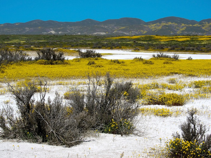
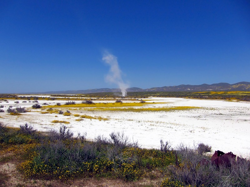
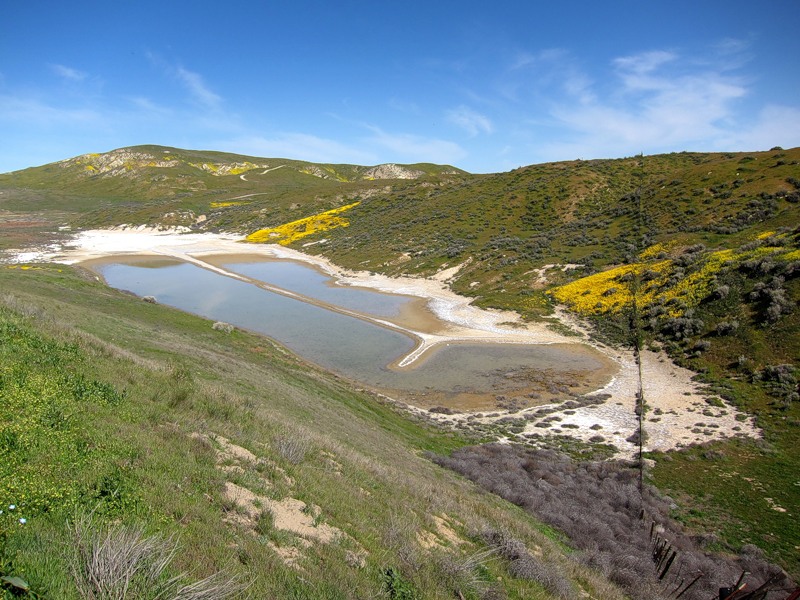
Альбом «Мои альбомы / Carrizo Plain (прерии), Калифорн.Цветы растут прямо на белой сульфатно-карбонатной поверхности Содового озера, частично пересохшего. |
(Soda Lake), оставшееся как напоминание о когда-то существовавшем здесь доисторическом море, сплошь покрыто коврами цветов, приспособившимися расти прямо на сверкающей, ослепительно белой сульфатно-карбонатной, напоминающей снег, поверхности. За зиму озеро испаряется, и только весной в нём наблюдается небольшое количество воды. Над поверхностью озера, раскаляющейся к середине дня, ветер поднимает напоминающие небольшие торнадо содовые вихри. |
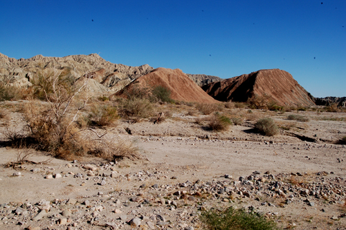
Carrizo Plain (прерии), Калифорния |
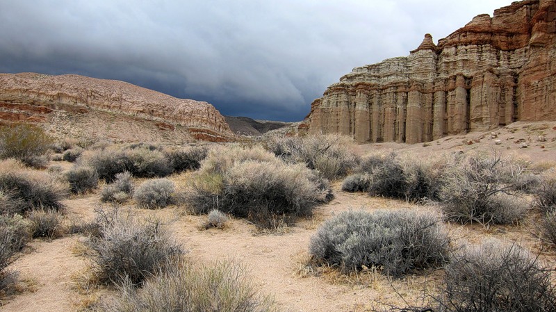
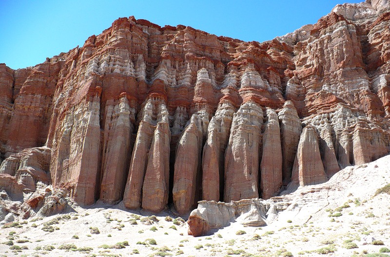
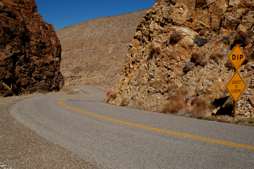
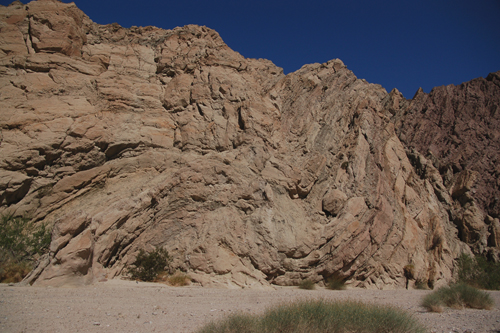
Red Rock Canyon, Калифорния |
Red Rock Canyon |
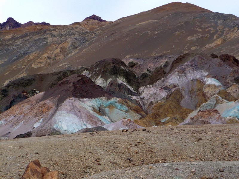
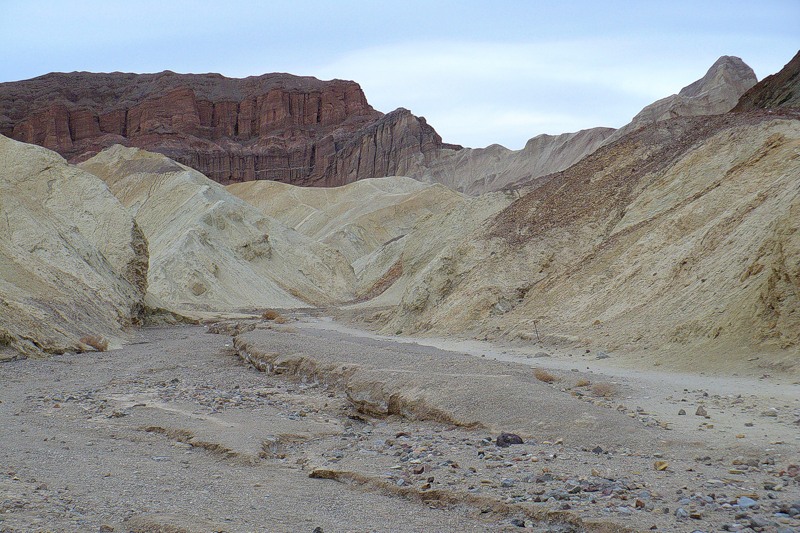
Death Valley |
|
Death Valley |
Part of the San Andreas Fault system by Palmdale, California: in order to get to the Owens valley, we had to leave the Pacific Plate and cross the fault |
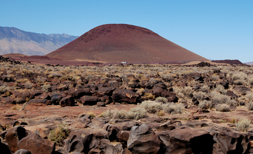
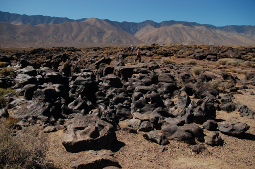
A cinder cone by Coso Junction, California: a series of volcanic explosions created rocks called pyroclasts, that eventually settled and formed this small volcanic cone |
The Fossil Falls by Coso Junction, California: a waterfall suspended in air, carved out of basalt by a river that was active during the last glaciation |
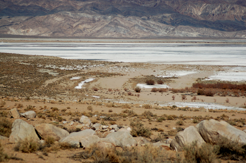
The so-called bathtub rings at Owens Lake, California: a retreating lake left a mark at its edge as a series of rings and ridges of salt |
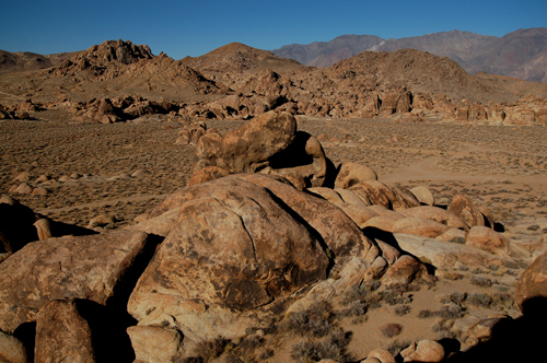
The Alabama Hills in Lone Pine, California: the mechanical and chemical weathering of granite leaves behind fantastic shapes;because of its scenery, this area has been used as a background for many western movies by the Hollywood industry |
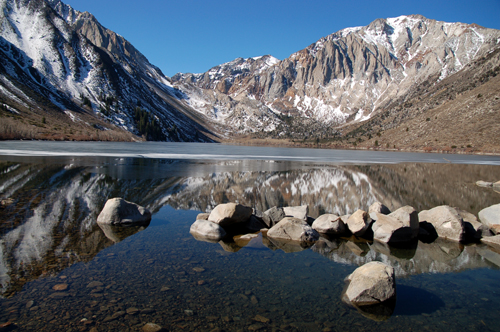
A glacial valley in Convict Lake, California: the classic U-shaped valley stands out beyond this glacial lake in the Sierra Nevada |
A glacial moraine extending east of the Sierra Nevada: a complete view of the U-shaped glacial valley and the sediments the glacier left behind |
A volcanic glass dome, north of Bishop, California:we have been walking on the rim of a vlcanic dome, looking for obsidian and other volcanic glass |
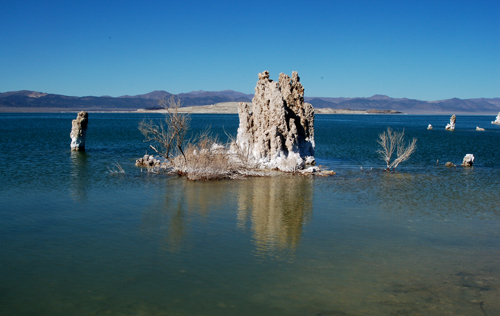
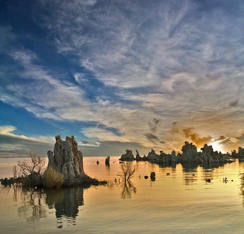
Tufa towers in Mono Lake, California: calcium carbonate-rich springs at the bottom of Mono Lake create this spectacular landscape.The lake level has been slowly but steadily rising, and many towers are now submerged,after the city of Los Angeles was forced to decrease its water intake from this area |
On a lonely road, on the western edge of Death Valley National Park, California, Looking at the outcrop |
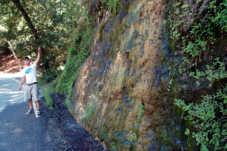
A natural spring along the Wheeler Gorge causes deposition of travertine, a form of limestone (CaCO3). Edson is pointing up to where the water comes to surface. |
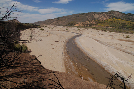
The broad alluvial plain of the Cuyama river shows gentle meanders and different alluvial bars. |
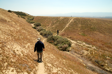
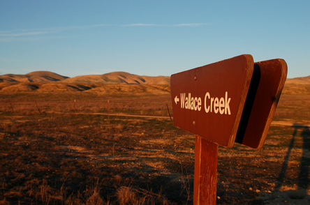
Crossing the San Andreas Fault caused the students to be spread over two different tectonic plates:the picture was taken from the North American Plate, looking across the San Andreas Fault,here coinciding with the small stream-incised valley of Wallace Creek, to the Pacific Plate |
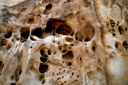
Wind erosion in sandstones caused the development of tafoni, or honeycomb structures.Wind erosion in sandstones caused the development of tafoni, or honeycomb structures.Many of these cavities are currently used by birds as a pre-made, protected nest. |
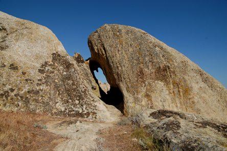
Sandstones are made of grains of sand, usually kept together by a cement.Sometimes weathering patterns can act differently on different grains. originating what we call differential erosion:in this case, more easily eroded materials have caused the development of a small arc along the pathway.A cement is a chemical precipitate that "glues" the individual grains one to the other. |
One last look across a plate boundary at Wallace Creek:this time we are on the Pacific Plate, while the mountains in the background belong to the North American plate.The North American plate extends from here all the way to the middle of the Atlantic Ocean, thousands of miles avay |
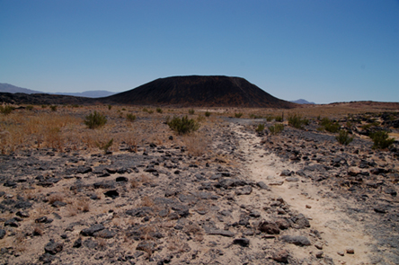
A mile-long hike took us to the Amboy Crater.This volcano stands out of a desert landscape formed by basaltic lava flows and Quaternary sediment.While the landscape seems to be very barren, we apparentlyhiked on "lizard day":big, multi-colored reptiles accompanied us to the base of the crater. |
Mono Lake |
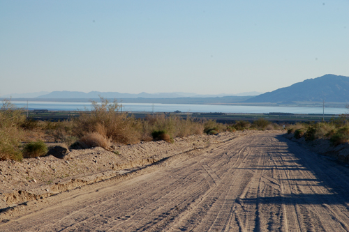
the Salton Sea, -228ft |
Painted Canyon |
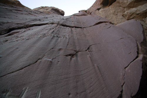
sandstone layers |
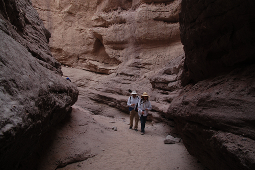
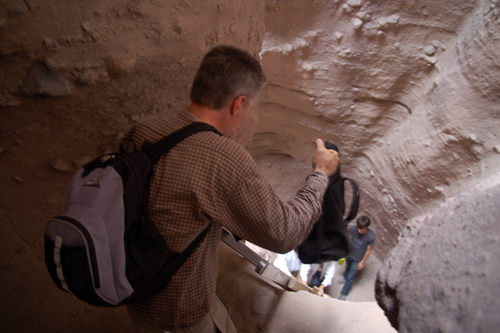
a slot canyon.The mouth of the canyon is actually hidden behind a landslide but after 20-30 minutes of ups and downs the path opens up and the surface becomes flat. |
the walls of the canyon were getting so close that only one of us could go throughand in a few points we had to climb on ladders that the Bureau of Land Management graciously put there for explorers like us |
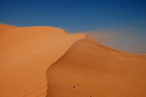
the Brawley - El Centro area. the Algodones Sand Dunes, Imperial Sand Dunes.Wind was strong as usual in this desert strip - observe sand in motion:this red-colored sand moves by saltation on the back of the dune and then falls at its front because of gravity - saw how the ripples are forming (lower left) and the advancement of the dune crest. |
the banks of the Salton Sea.This is where a series of volcanic extrusions created a big black mound that goes by the name of Obsidian Hill. |
A couple of mile north, still on the banks of the Salton Sea, is Red Hill:an altered mound of rhyolite, a silicic extrusive igneous rock, standing high on the water.Rapid oscillations of the water level might leave wide muddy areas exposed, as is evident in this image. |
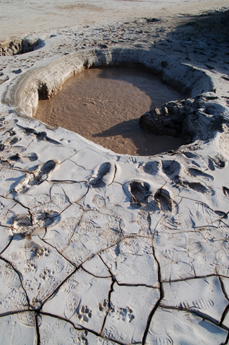
Further north is a field of mud volcanoes.Gases rising to the surface, mostly carbon dioxide, cause liquefaction of muddy sediments;liquified mud is then ejected at the surface, creating a little cone around the vent.While there is a link to plate tectonic activity, these are not real volcanoes!In this image you can see the mud (and its shadow!) rising through the vent and also the trace of the impact of the individual pulses on the "crater" of the volcano. |
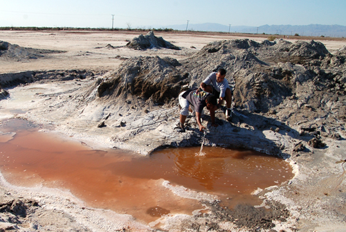
Water can collect in pools that fill depressions that form around the volcanoes. This water contains a lot of salt and tends to evaporate, favoring the deposition of minerals. Some of these waters are at high temperatures and host a variety of bacteria that thrive in these conditions. In this image Hammam and Marlon collect water from the brine pool. |
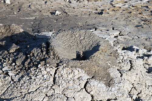
Sometimes gas is released from underneath a pool, or a crater gets filled with water.The result is a pool of bubbling muddy water, like in this image.Notice the pattern of mud cracks all around this little vent. |
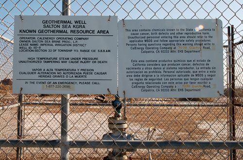
Here is a geothermal well whose waters are used to generate electrical energy |
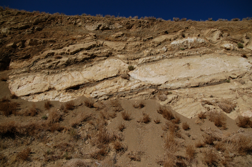
Back to sedimentary rocks: this is a dry waterfall that tells us two different stories. The first refers to the present,and is told by the vertical ridges in this image:when water drips along the wall, it easily erodes sand and finer sediments;but when the water encounters bigger grains, such as gravel, it will just go around them, creating an erosion shadow" that will result in a ridge of non-eroded sediment.The second story can be read in the horizontal lineaments:you can see cross-bedded lamination (lower part) and a series of gravel lenses (middle and upper parts)that tell us that this sandstone was originally deposited following a very swift river current. |
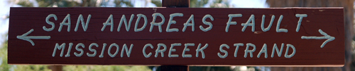
Let''s not forget that we are very, very close to the San Andreas Fault!Deformation along this plate boundary might result in local compression or extension in the surrounding rocks.In this image, tectonic compression has cause some of the sedimentary layers to bend, or fold,in structures called anticlines (like the fold to the left, pointing upward), and synclines (like the bent layers to the right, pointing downward). |
The San Andreas Fault itself shows its presence here by causing an alignment of very distinct rocks at the mouth of Painted Canyon |
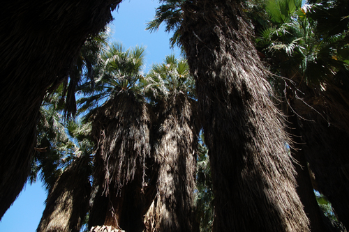
the Palm Springs area,At the 1000 Palms Oasis, a trail takes visitors along the San Andreas Fault. At this location the fault causes underground water to upwell to the surface. As a consequence, a very thick palm oasis developed along the fault. |
palm oasis |
Books:
C. C. Plummer and D. H. Carlson
Physical Geology (12th edition)
Richard M. Busch (editor)
Laboratory Manual
in Physical Geology
(7th edition)
Steven M. Stanley
Earth System History (3rd edition)
W. H. Freeman and Company, New York
J. William Schopf
Cradle of Life (1st edition)
Princeton University Press, Princeton and Oxford
Levin, H.L., and Smith, M.S.
Laboratory Studies
in Earth History
(9th edition)
McGraw Hill Higher Education, New York
A. P. Trujillo and H. V. Thurman
Essentials of Oceanography (9th edition)
Deborah Harden
California Geology (2nd edition)
Geological Society of America (GSA)
International Commission on Stratigraphy (ICS)
International Association of Sedimentologists (IAS)
Society for Sedimentary Geology (SEPM)
American Association of Petroleum Geologists (AAPG)
Paleontological Society
American Geologic Institute (AGI)
American Geophysical Union (AGU)
American Association for the Advancement of Science
National Science Foundation
Sigma Xi
USA: United States Geological Survey (USGS)
Canada: Geological Survey of Canada (GSC)
United Kingdom: British Geological Survey (BGS)
Australia: Geoscience Australia
New Zealand: GNS Science
France: Bureau de Recherches Geologique and Minieres (BRGM) (in French and English)
Italy: Agenzia per la Protezione dell''Ambiente e per i Servizi Tecnici (APAT) (in Italian and English)
Italy (Emilia Romagna): Servizio Geologico dell''Emilia Romagna (in Italian, English, German, Spanish, Arabic, Russian and French)
Denmark: Geological Survey of Denmark and Greenland
Southern California Earthquake Center (SCEC)
Национальный парк Долина Смерти (англ. Death Valley National Park) является наиболее засушливым национальным парком в США, расположенном к востоку от горного хребта Сьерра-Невада в штате Калифорния, США, а также в небольшом анклаве в штате Невада. Площадь парка составляет 13,518 км² , включает в себя долину Салина, большую часть долины Панаминт, почти всю долину Смерти, а также территории нескольких горных систем. Парк имеет самый сухой и самый жаркий климат среди национальных парков Соединённых Штатов, в нём в месте, известном как Бэдуотер (англ. Badwater), расположена вторая по глубине наземная точка в западном полушарии — 86 м ниже уровня моря.
До присвоения парку природоохранного статуса здесь в основном занимались золотодобычей. Первые известные американцы некоренного происхождения пришли на эту землю зимой 1849 года, полагая, что они сэкономят время, сократив путь до золотых приисков Калифорнии. После нескольких недель путешествия и потеряв одного человека умершим, они в конце концов решили назвать это место Долиной Смерти. В конце XIX — начале XX века в долине появилось несколько быстрорастущих поселений, жители которых занимались золотодобычей, однако эти поселения оказались недолговечными. Единственной долговременной доходной рудой оказалась бура — минерал, использовавшийся для производства мыла и в промышленности. Для транспортировки этой руды использовались повозки, запряжённые 20 мулами — впоследствии такая необычная практика транспортировки стала основой для создания многочисленных книг, радио и телепередач, а также кинофильмов. Национальным памятником долина Смерти была объявлена в 1933 году, после чего она попала под охрану государства. В 1994 году статус национального памятника был заменён на статус национального парка, в этом же году территория парка была расширена, включив в себя долины Салина и Юрика.
Окружающая среда парка стала результатом геологических преобразований на этой территории, которые имеют долгую и сложную историю. Самые старые горные породы образовались в результате метаморфозных изменений по крайней мере 1700 млн лет назад. В древности находившиеся на этом месте тёплые и мелководные внутренние моря оставяли обширные морские отложения; и так продолжалось до тех пор, пока расщелина не открыла путь в Тихий океан. Отложения продолжались и далее до тех пор, пока зона субдукции не сформировала прибрежную зону. Образовавшиеся на западе горы и ряд вулканов закрыли путь к океану. Позднее земная кора стала разрываться, создав аридный рельеф, который мы наблюдаем сегодня. Долины были заполнены осадочными породами, а в сырые времена ледниковых периодов озёрами, такими как озеро Менли.
Парк является местом обитания многих растений и животных, приспособившихся к суровому пустынному климату. Среди обитателей национального парка можно назвать ларрею трёхзубчатую (лат. Larrea tridentata), снежного барана (лат. Ovis canadensis), койота (лат. Canis latrans) и пустынную рыбку Cyprinodon salinus, одного из немногих выживших видов, сохранившихся с тех времён, когда климат был более влажным. Примерно 95 % процентов территории парка считается дикой и неосвоенной.
http://homepage.smc.edu/grippo_alessandro/ - Field Geology
the Owens Valley and Mono Lake,
Wheeler Gorge and the Carrizo Plain,
the Mojave Desert and the Mitchell Caverns,
the Salton Sea Trough and the Palm Springs area,
Death Valley National Park